
Today we are going to spend some time on the subject of clouds. Understanding the various types of clouds is important to pilots as clouds are direct indicators of the type of weather that one can expect. Having the ability to understand and correlate the meaning of a particular cloud as it relates to weather will enable you as a pilot to draw a better overall picture of conditions that may affect your flight.
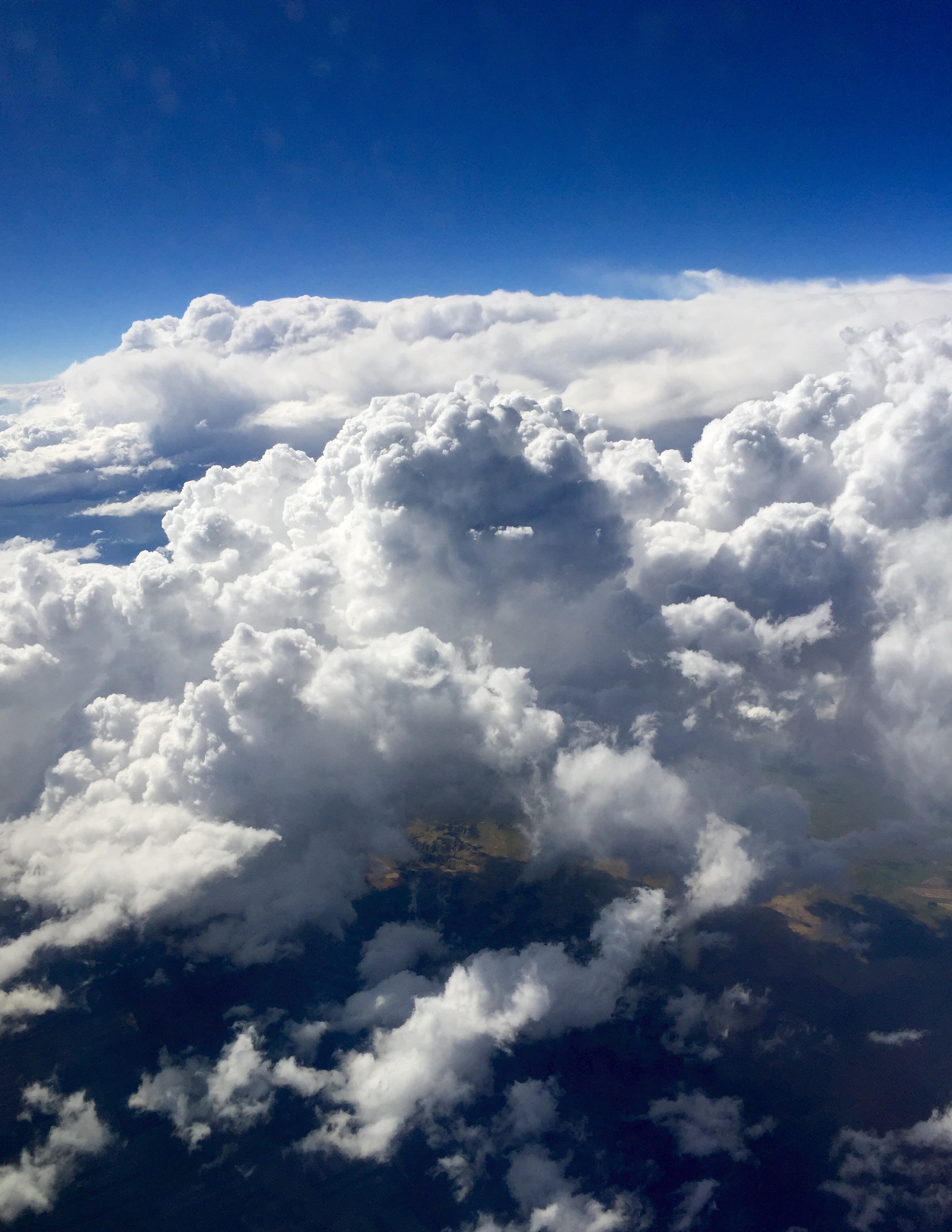
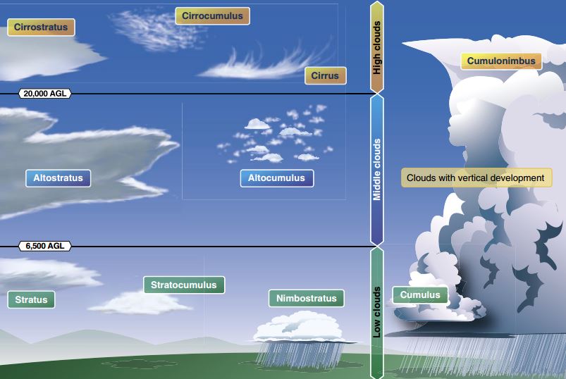
Firstly, clouds are classified into one of four families solely by their height: low, middle, high, and clouds with extensive vertical development. Low-level clouds are those clouds from the surface to 6,500 feet AGL. Common types are stratus, stratocumulus, nimbostratus and even fog. These are the types of clouds that will often hamper your ability to fly by visual flight rules. Middle clouds range from 6,500 AGL up to 20,000 feet AGL. These include altostratus, altocumulus, and nimbostratus types. Things to anticipate in these types of clouds are turbulence and the possibility of icing. High clouds, not often encountered by the Private Pilots, form above 20,000 feet AGL and do not normally pose any real threat of icing conditions or turbulence. Types include cirrus, cirrostratus, and cirrocumulus. Lastly we have clouds with extensive vertical development, like towering cumulus and cumulonimbus types. These form anywhere in the low or middle cloud level and may extend high into the sky. This family of clouds paints a picture of instability in the atmosphere and is associated with turbulent rough air and the possibility of hazardous weather conditions.
Beyond the four families of height, clouds are named by type according to the composition and appearance.
Cumulus—heaped or piled clouds (mashed potatoes)
Stratus—formed in layers
Cirrus—fibrous clouds and those above 20,000 feet AGL
Castellanus—often looks like a tiered weeding cake or castle, a single base with separate vertical development
Lenticularus—similar appearance to a lens, encountered in mountainous areas and formed with strong winds
Nimbus—rain clouds
Fracto—broken
Alto—clouds from 5,000 to 20,000 feet AGL
So, for example, a cumulonimbus cloud would be a mashed potato looking cloud with rain as seen in the figure below.
Below are a few questions that you may possibly encounter on the Private Pilot Knowledge Exam. See if you can answer them from the information provided in this week’s post. For additional information, check out Chapter 11 of the Pilots Handbook of Aeronautical Knowledge.
1. If an unstable air mass is forced upward, what type clouds can be expected?
A—Stratus clouds with little vertical development.
B—Stratus clouds with considerable associated turbulence.
C—Clouds with considerable vertical development and associated turbulence.
2. The suffix ‘nimbus,’ used in naming clouds, means
A—a cloud with extensive vertical development.
B—a rain cloud.
C—a middle cloud containing ice pellets.
3. Clouds are divided into four families according to their
A—outward shape.
B—height range.
C—composition.
4. What clouds have the greatest turbulence?
A—Towering cumulus.
B—Cumulonimbus.
C—Nimbostratus.


