
This week, we’re taking another look at aviation forecasts and focusing on the terminal aerodrome forecast (TAF), one of the printed forecasts that all pilots need to be familiar with. TAFs are designed to be useful in the preflight planning stage. Here’s how the FAA breaks down a TAF in the Pilot’s Handbook of Aeronautical Knowledge.
A TAF is a report established for the five statute mile radius around an airport. TAF reports are usually given for larger airports. Each TAF is valid for a 30-hour time period, and is updated four times a day at 0000Z, 0600Z, 1200Z, and 1800Z. The TAF utilizes the same descriptors and abbreviations as used in the METAR report. The TAF includes the following information in sequential order:
- Type of report—a TAF can be either a routine forecast (TAF) or an amended forecast (TAF AMD).
- ICAO station identifier—the station identifier is the same as that used in a METAR.
- Date and time of origin—time and date of TAF origination is given in the six-number code with the first two being the date, the last four being the time. Time is always given in UTC as denoted by the Z following the number group.
- Valid period date and time—the valid forecast time period is given by a six-digit number group. The first two numbers indicate the date, followed by the two-digit beginning time for the valid period, and the last two digits are the ending time.
- Forecast wind—the wind direction and speed forecast are given in a five-digit number group. The first three indicate the direction of the wind in reference to true north. The last two digits state the windspeed in knots as denoted by the letters “KT.” Like the METAR, winds greater than 99 knots are given in three digits.
- Forecast visibility—given in statute miles and may be in whole numbers or fractions. If the forecast is greater than six miles, it will be coded as “P6SM.”
- Forecast significant weather—weather phenomena are coded in the TAF reports in the same format as the METAR. If no significant weather is expected during the forecast time period, the denotation “NSW” is included in the “becoming” or “temporary” weather groups.
- Forecast sky condition—given in the same manner as the METAR. Only cumulonimbus (CB) clouds are forecast in this portion of the TAF report as opposed to CBs and towering cumulus in the METAR.
- Forecast change group—for any significant weather change forecast to occur during the TAF time period, the expected conditions and time period are included in this group. This information may be shown as from (FM), becoming (BECMG), and temporary (TEMPO).
- “FM” is used when a rapid and significant change, usually within an hour, is expected. “BECMG” is used when a gradual change in the weather is expected over a period of no more than 2 hours. “TEMPO” is used for temporary fluctuations of weather, expected to last less than one hour.
- Probability forecast—a given percentage that describes the probability of thunderstorms and precipitation occurring in the coming hours. This forecast is not used for the first 6 hours of the 24-hour forecast.
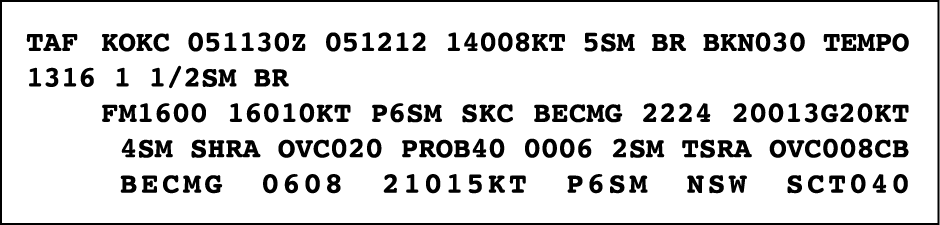
Example:
TAF
KPIR 111130Z 111212 15012KT P6SM BKN090
TEMPO 1214 5SM BR
FM1500 16015G25KT P6SM SCT040 BKN250
FM0000 14012KT P6SM BKN080 OVC150 PROB40 0004
3SM TSRA BKN030CB
FM0400 1408KT P6SM SCT040 OVC080
TEMPO 0408 3SM TSRA OVC030CB
BECMG 0810 32007KT=
Explanation:
Routine TAF for Pierre, South Dakota…on the 11th day of the month, at 1130Z…valid for 24 hours from 1200Z on the 11th to 1200Z on the 12th…wind from 150° at 12 knots…visibility greater than 6 sm…broken clouds at 9,000 feet…temporarily, between 1200Z and 1400Z, visibility 5 sm in mist…from 1500Z winds from 160° at 15 knots, gusting to 25 knots visibility greater than 6 sm…clouds scattered at 4,000 feet and broken at 25,000 feet…from 0000Z wind from 140° at 12 knots…visibility greater than 6 sm…clouds broken at 8,000 feet, overcast at 15,000 feet…between 0000Z and 0400Z, there is 40 percent probability of visibility 3 sm…thunderstorm with moderate rain showers…clouds broken at 3,000 feet with cumulonimbus clouds…from 0400Z…winds from 140° at 8 knots…visibility greater than 6 miles…clouds at 4,000 scattered and overcast at 8,000…temporarily between 0400Z and 0800Z…visibility 3 miles…thunderstorms with moderate rain showers…clouds overcast at 3,000 feet with cumulonimbus clouds…becoming between 0800Z and 1000Z…wind from 320° at 7 knots…end of report (=).
Look for more on deciphering TAFs from our CFI on Thursday. Other essential resources on weather services are the recently updated FAA text Aviation Weather Services (AC 00-45G.2) and Chapter 7 of the AIM, printed annually in ASA’s FAR/AIM.


