
Understanding the imaginary grid we’ve laid out around and across our planet is key in flight planning and ultimately your safety. Today, we’ll review some of the basics with help from the FAA textbook Pilot’s Handbook of Aeronautical Knowledge.
The equator is an imaginary circle equidistant from the poles of the Earth. Circles parallel to the equator (lines running east and west) are parallels of latitude. They are used to measure degrees of latitude north (N) or south (S) of the equator. The angular distance from the equator to the pole is one-fourth of a circle or 90°. The 48 conterminous states of the United States are located between 25° and 49° N latitude. The arrows in the figure below labeled “Latitude” point to lines of latitude.
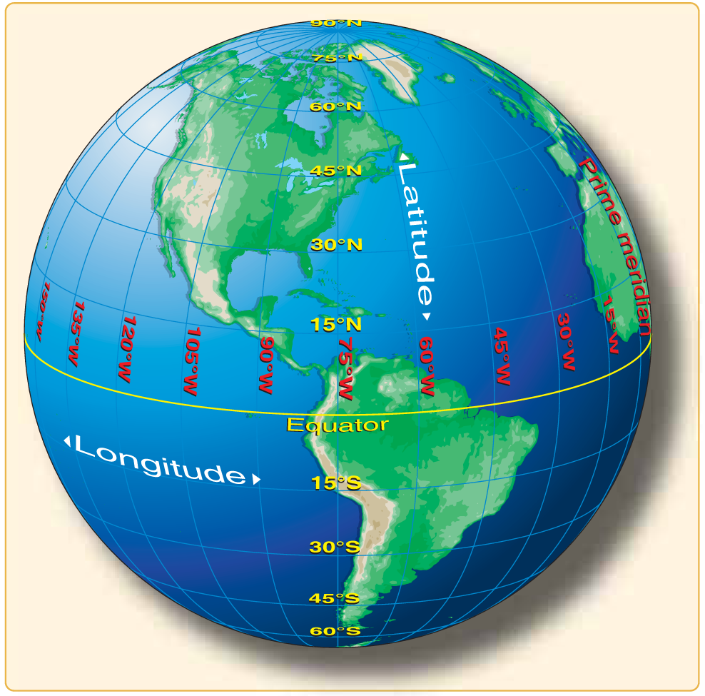
Meridians of longitude are drawn from the North Pole to the South Pole and are at right angles to the Equator. The “Prime Meridian” which passes through Greenwich, England, is used as the zero line from which measurements are made in degrees east (E) and west (W) to 180°. The 48 conterminous states of the United States are between 67° and 125° W longitude. The arrows in the figure above labeled “Longitude” point to lines of longitude.
Any specific geographical point can be located by reference to its longitude and latitude. Washington, D.C., for example, is approximately 39° N latitude, 77° W longitude. Chicago is approximately 42° N latitude, 88° W longitude.
The meridians are also useful for designating time zones. A day is defined as the time required for the Earth to make one complete rotation of 360°. Since the day is divided into 24 hours, the Earth revolves at the rate of 15° an hour. Noon is the time when the sun is directly above a meridian; to the west of that meridian is morning, to the east is afternoon. The standard practice is to establish a time zone for each 15° of longitude. This makes a difference of exactly 1 hour between each zone.
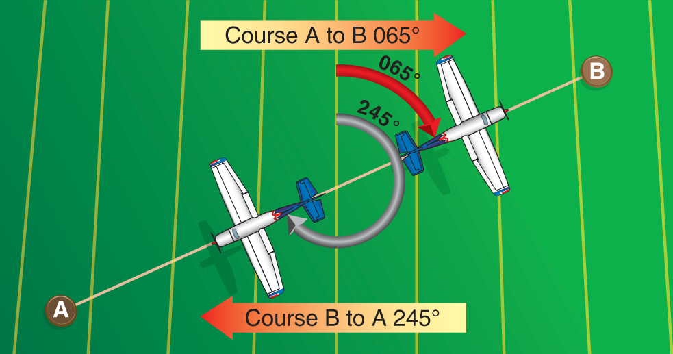
By using the meridians, direction from one point to another can be measured in degrees, in a clockwise direction from true north. To indicate a course to be followed in flight, draw a line on the chart from the point of departure to the destination and measure the angle which this line forms with a meridian. Direction is expressed in degrees.
Because meridians converge toward the poles, course measurement should be taken at a meridian near the midpoint of the course rather than at the point of departure. The course measured on the chart is known as the true course (TC). This is the direction measured by reference to a meridian or true north. It is the direction of intended flight as measured in degrees clockwise from true north.
As shown in the figure below, the direction from A to B would be a true course of 065°, whereas the return trip (called the reciprocal) would be a true course of 245°.
The true heading (TH) is the direction in which the nose of the aircraft points during a flight when measured in degrees clockwise from true north. Usually, it is necessary to head the aircraft in a direction slightly different from the true course to offset the effect of wind. Consequently, numerical value of the true heading may not correspond with that of the true course. For the purpose of this discussion, assume a no-wind condition exists under which heading and course would coincide. Thus, for a true course of 065°, the true heading would be 065°. To use the compass accurately, however, corrections must be made for a magnetic variation and compass deviation.


