When preparing for an FAA Knowledge Exam, studying the correct information is key. ASA Test Preps and Prepware include the necessary study information, in addition to representative FAA knowledge test questions that allow you to simulate the experience of taking the test. Today, we’re going to talk about clouds and cloud bases.
As a student pilot, you will find that weather often affects your flying experience. Because a pilot must follow rules and regulations around visibility and distance from clouds, being able to quickly determine the base of a cumulus cloud is a necessary skill. First, here are some Private Pilot FAA Knowledge Exam sample questions taken from our Private Pilot Test Prep. (A couple of abbreviations to know: MSL is mean sea level and AGL is above ground level.)
1. What is the approximate base of the cumulus clouds if the surface air temperature at 1,000 feet MSL is 70°F and the dew point is 48°F?
A— 4,000 feet MSL.
B— 5,000 feet MSL.
C— 6,000 feet MSL.
2. At approximately what altitude above the surface would the pilot expect the base of cumuliform clouds if the surface air temperature is 82°F and the dew point is 38°F?
A— 9,000 feet 78 AGL.
B— 10,000 feet AGL.
C— 11,000 feet AGL.
Before we learn the answers, let’s look at clouds and how they form.
Clouds
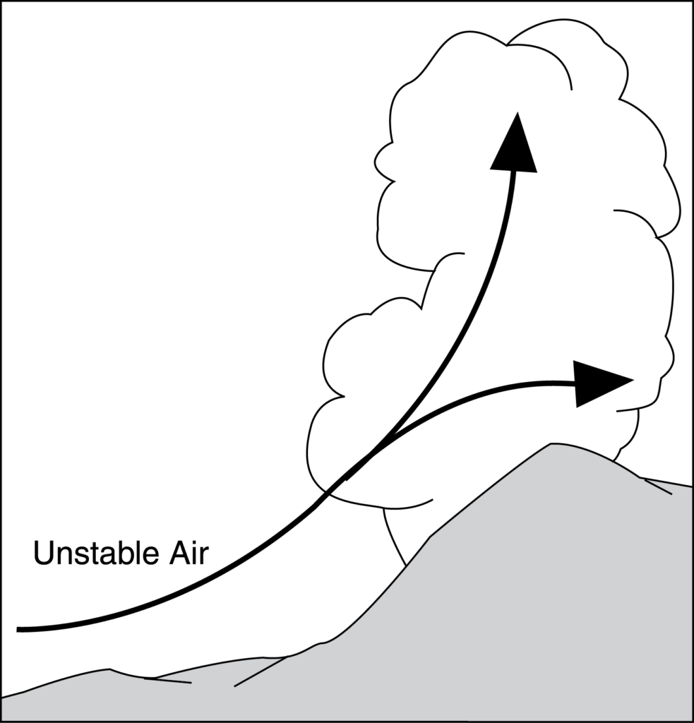
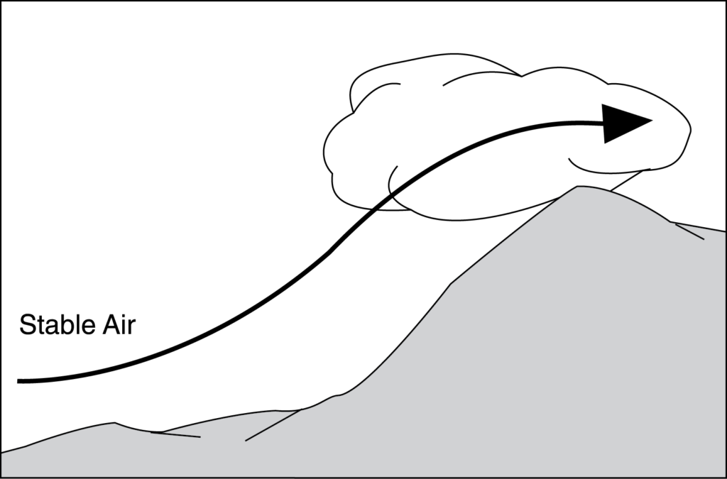
The stability of the atmosphere (the resistance of the atmosphere to vertical motion) determines which of two types of clouds will be formed: cumuliform or stratiform.
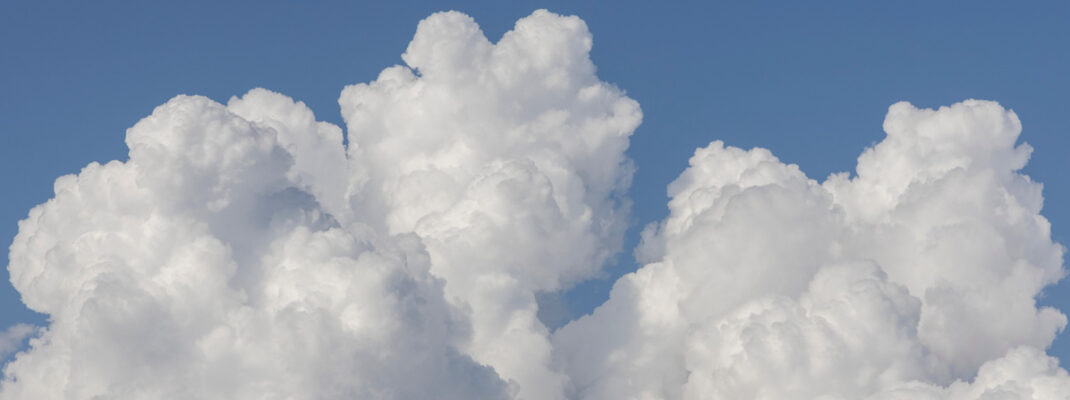
Cumuliform clouds are the billowy-type clouds having considerable vertical development, which enhances the growth rate of precipitation. They are formed in unstable conditions, and they produce showery precipitation made up of large water droplets.
Stratiform clouds are the flat, more evenly based clouds formed in stable conditions. They produce steady, continuous light rain and drizzle made up of much smaller raindrops.
Clouds can also be divided into four families according to their height range: low, middle, high, and clouds with extensive vertical development.
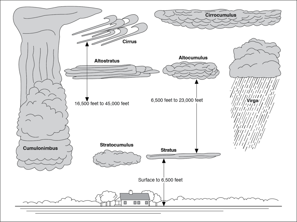
The first three families—low, middle, and high—are further classified according to the way they are formed. Clouds formed by vertical currents (unstable) are cumulus (heap) and are billowy in appearance. Clouds formed by the cooling of a stable layer are stratus (layered) and are flat and sheet-like in appearance. A further classification is the prefix “nimbo-” or suffix “-nimbus,” which means raincloud.
High clouds, called cirrus, are composed mainly of ice crystals; therefore, they are least likely to contribute to structural icing (since structural icing requires water droplets).
The base of a cloud above ground level (AGL) that is formed by vertical currents (cumuliform clouds) can be roughly calculated by dividing the difference between the surface temperature and dew point by 4.4 and multiplying the rounded result by 1,000. The convergence of the temperature and the dew point lapse rate is 4.4°F per 1,000 feet.
Here’s a practice problem: What is the approximate base of the cumulus clouds if the surface air temperature is 70°F and the dew point is 61°F?
Solution: Use the following steps:
Step 1: 70°F (Surface temperature) – 61°F (Dew point) = 9°F
Step 2: 9 ÷ 4.4 = 2.05 or 2
Step 3: 2 × 1,000 = 2,000 feet AGL (base of cloud)
Answers
Now, let’s look at our questions from above:
1. What is the approximate base of the cumulus clouds if the surface air temperature at 1,000 feet MSL is 70°F and the dew point is 48°F?
A— 4,000 feet MSL.
B— 5,000 feet MSL.
C— 6,000 feet MSL.
The answer is C, 6,000 feet MSL. When lifted, unsaturated air cools at approximately 5.4°F per 1,000 feet. The dew point cools at approximately 1°F per 1,000 feet. Therefore, the convergence of the temperature and dew point lapse rates is 4.4°F per 1,000 feet. The base of a cloud (AGL) that is formed by vertical currents can be roughly calculated by dividing the difference between the surface temperature and the dew point by 4.4 and multiplying the rounded result by 1,000.
Repeating the steps learned above:
Step 1: 70°F (Surface temperature) – 48°F (Dew point) = 22°F
Step 2: 22 ÷ 4.4 = 5
Step 3: 5 × 1,000 = 5,000 feet AGL
Step 4: 5,000 feet AGL + 1,000 feet field elevation = 6,000 feet MSL
2. At approximately what altitude above the surface would the pilot expect the base of cumuliform clouds if the surface air temperature is 82°F and the dew point is 38°F?
A— 9,000 feet AGL.
B— 10,000 feet AGL.
C— 11,000 feet AGL.
The answer is B, 10,000 feet AGL. Again, repeating the steps above:
Step 1: 82°F (Surface temperature) – 38°F (Dew point) = 44°F
Step 2: 44 ÷ 4.4 = 10
Step 3: 10 × 1,000 = 10,000 feet AGL
These questions both refer to the Learning Statement Code PLT512 (Weather/Meteorology/Fog; Moisture; Stability; Temperature), if using an FAA Practical Test Standard, and the Airman Certification Standard (ACS) code PA.I.C.K3f (Clouds) for those tests with an ACS. To find more information on this subject check out the Aviation Weather Handbook (FAA-H-8083-28).