
Out here in the Pacific Northwest, there’s a saying: if you don’t like the weather, wait five minutes. Whether or not your weather changes as fast as ours does, knowing what to expect is still critical to flight safety. Radar helps us track weather nearly in real-time and make visual sense of what to expect where. Today we’ll talk about radar weather reports. Check out our previous weather services posts, and our introduction. Today’s post comes from the FAA’s Pilot’s Handbook of Aeronautical Knowledge (8083-25).
Radar Observations
Weather observers use four types of radar to provide information about precipitation, wind, and weather systems.
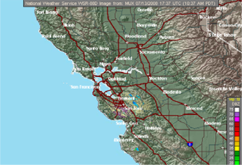
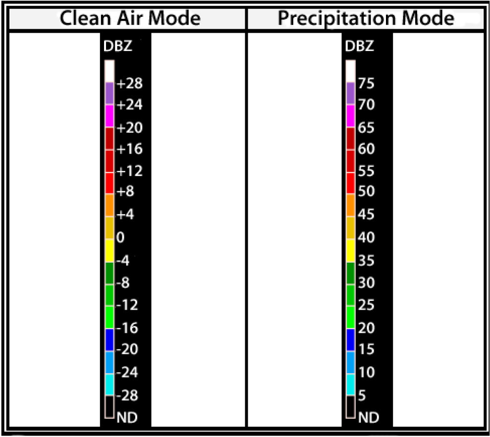
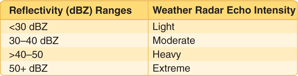
- The WSR-88D NEXRAD radar, commonly called Doppler radar, provides in-depth observations that inform surrounding communities of impending weather. Doppler radar has two operational modes: clear air and precipitation. In clear air mode, the radar is in its most sensitive operational mode because a slow antenna rotation allows the radar to sample the atmosphere longer. Images are updated about every 10 minutes in this mode. Precipitation targets provide stronger return signals therefore the radar is operated in the Precipitation mode when precipitation is present. A faster antenna rotation in this mode allows images to update at a faster rate, approximately every 4 to 6 minutes. Intensity values in both modes are measured in dBZ (decibels of Z) and depicted in color on the radar image. Intensities are correlated to intensity terminology (phraseology) for air traffic control purposes.
- FAA terminal doppler weather radar (TDWR), installed at some major airports around the country, also aids in providing severe weather alerts and warnings to ATC. Terminal radar ensures pilots are aware of wind shear, gust fronts, and heavy precipitation, all of which are dangerous to arriving and departing aircraft.
- The third type of radar commonly used in the detection of precipitation is the FAA airport surveillance radar. This radar is used primarily to detect aircraft, but it also detects the location and intensity of precipitation which is used to route aircraft traffic around severe weather in an airport environment.
- Airborne radar is equipment carried by aircraft to locate weather disturbances. The airborne radars generally operate in the C or X bands (around 6 GHz or around 10 GHz, respectively) permitting both penetration of heavy precipitation, required for determining the extent of thunderstorms, and sufficient reflection from less intense precipitation.


